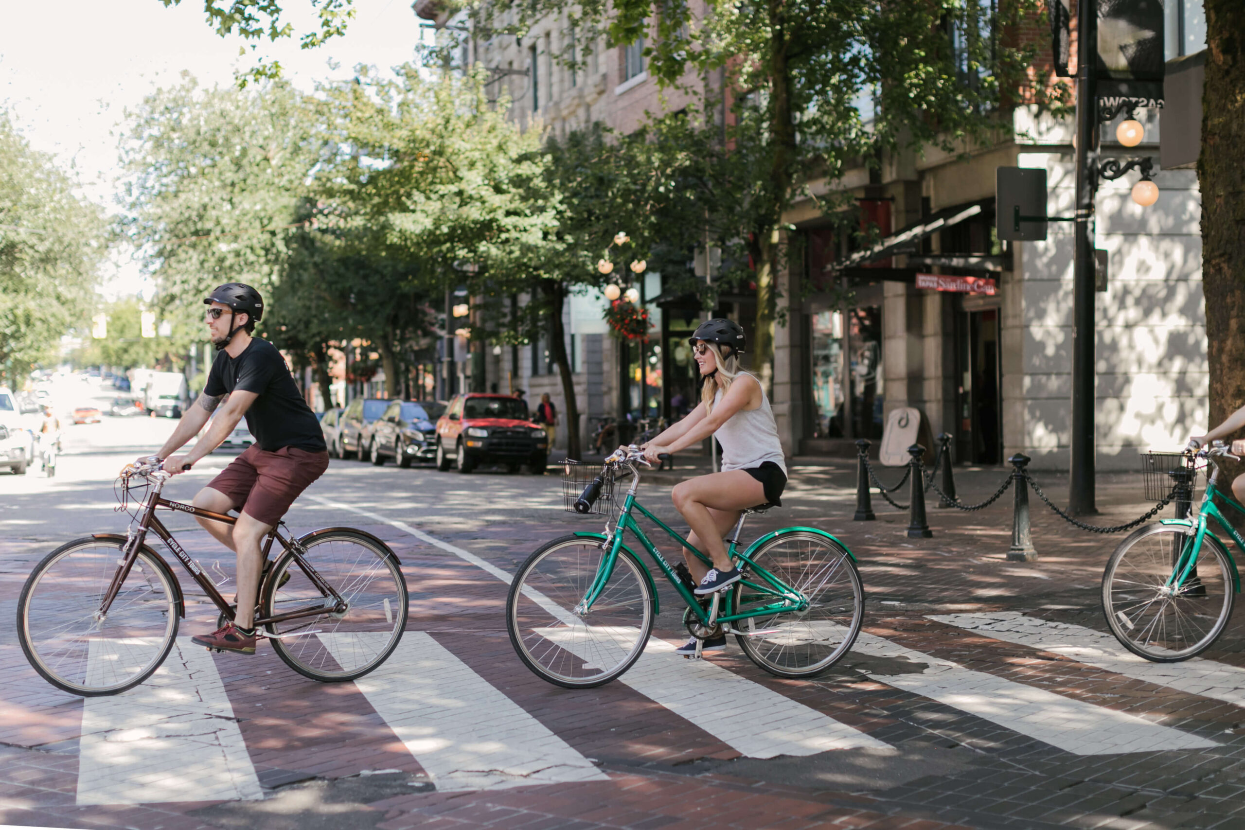
Picture this: you are in one of the most bikeable cities in the world, you have a free afternoon, and every travel guide is pointing you to the exact same route everyone else is riding.
Sound familiar?
Vancouver’s Stanley Park Seawall is genuinely one of the most beautiful urban cycling routes on the planet, and we will never talk you out of riding it. But if you’ve already done it, or you are looking for something that feels a little more local and a little off the beaten track, you are in the right place.
This guide covers four scenic bike rides in Vancouver that locals ride regularly and visitors almost never find.
Key Takeaways:
- What makes a great Vancouver route: Not all bike paths are created equal. We share the four criteria every route in this guide meets before you set off.
- The Arbutus Greenway: A relatively flat, car-free former railway corridor through some of Vancouver’s most charming neighbourhoods. Easy, quiet, and completely off the tourist trail.
- The Seaside Route to Spanish Banks: Follow the shoreline west through four beaches, each one less crowded than the last.
- The Central Valley Greenway: 24 kilometres connecting Vancouver to New Westminster. The route for riders who want to actually go somewhere.
- Queen Elizabeth Park via the Arbutus Greenway: Two of Vancouver’s most beautiful green spaces in one varied loop. The climb is real. The views are worth every pedal stroke.
Ready to find out which one is right for your day? Let’s get into it.
Why Everyone Ends Up on the Same Path (And What to Do Instead)
If you have spent any time researching things to do in Vancouver, you have probably noticed something. Nearly every travel guide, tourism website, and “best of” list points you to the same place: the Seawall.
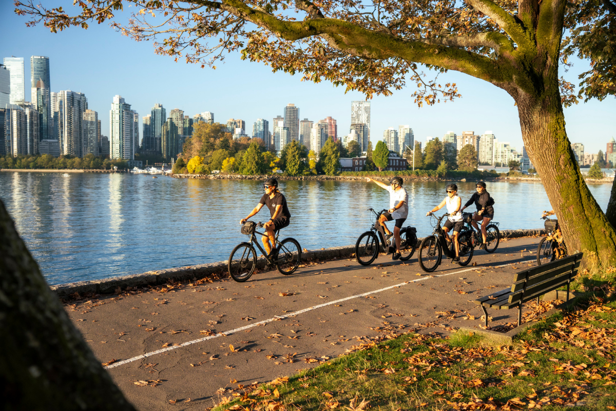
And honestly, for good reason. The Stanley Park Seawall is a 28-kilometre waterfront path that wraps around one of the largest urban parks in North America, with views of the harbour, the North Shore mountains, and English Bay that are genuinely hard to believe until you are standing in front of them. It belongs on every first-time visitor’s list, and we will never tell you otherwise.
What we will tell you is that Vancouver rewards riders who are curious enough to go a little further.
Because here is something most visitors never find out: Vancouver has over 450 kilometres of bikeways. Some run along the waterfront. Others cut through quiet residential neighbourhoods, follow old railway corridors, or climb up to hilltop parks with views of the whole city laid out below. They are well-maintained, traffic-separated, and genuinely beautiful. They just do not show up on the average tourist itinerary.
That is exactly the gap this guide is here to fill. If you have a second day in Vancouver, a free afternoon, or simply the curiosity to see the city the way locals actually ride it, the four routes below are some of the best hidden gem bike paths Vancouver has to offer. Each one is accessible directly from downtown, suited to a range of fitness levels, and offers something distinct from anything you will find on the Seawall.
As Joe from Portland said after riding with us: “I have been to Vancouver three times before but never seen such a sampling of the city’s culture, tastes, sights, and history.” That is what happens when you give yourself permission to explore beyond the obvious.
Cycle City Tip: Not sure which route fits your plans? Start by thinking about what kind of experience you are after. Vancouver’s bike network has something for every pace and every mood, and the best route is simply the one that matches how you want to spend your time in the city.
The Anatomy of a Perfect Vancouver Bike Route
Most people think it comes down to scenery. It does not. After 15 years of riding this city with guests from all over the world, we have developed a clear sense of what separates a good route from a genuinely great one, and we think it is worth sharing them upfront so you know exactly what you are getting into before you set off for your next ride.
It keeps you away from traffic. Every route here runs on dedicated cycling infrastructure, whether that is a protected greenway, a car-free path, or a separated bike lane. You are not navigating alongside traffic or sharing a lane with buses. You can actually look up from the road and take in the city around you.
It gives you something worth stopping for. A great route is not just about the kilometres. It is about what you find along the way. Each route in this guide passes through something worth pausing for, whether that is a waterfront view, a neighbourhood worth wandering into, or a park worth sitting in for a while.
It is accessible from downtown. You should not need a car, a SkyTrain connection, or a complicated logistics plan to start your ride. Every route here begins within easy reach of the city centre, so you can get on your bike and go.
It works for more than one type of rider. Some of these routes are flat and relaxed, well suited to someone who has not been on a bike in a while. One of them offers real distance and a proper climb for riders who want to work for their views. We have noted the character of each one so you can choose with confidence before you set off.
Every route in this guide was chosen because it meets all four of these criteria. Not just one or two.
Cycle City Tip: Before you head out on any unfamiliar route, take two minutes to download or screenshot an offline version of your Vancouver cycling map. Vancouver’s bike paths are well signed, but having your route saved locally means you are never dependent on a data connection to find your way.
Prefer to let someone else handle the navigation? Our guided tours cover the best of Vancouver by bike, with local guides who know every stop worth making along the way. See Our Vancouver Bike Tours
Route 1: The Arbutus Greenway
A former railway corridor through the heart of the city
Distance: 9 km one way | Surface: Paved | Difficulty: Easy | Best for: All levels
Most visitors to Vancouver have never heard of the Arbutus Greenway. That is exactly what makes it worth riding.
The Arbutus Greenway has transformed a 9-kilometre stretch of old railway corridor into a walking, biking, and rolling path from False Creek to the Fraser River. The City of Vancouver purchased the land from Canadian Pacific Railway in 2016, and what was once an unused rail line through the middle of the city is now one of its most pleasant cycling routes. The railway history is part of what gives it its character: the path runs in a straight, gentle line through neighbourhoods that most tourists never pass through, past community gardens, local cafes, and front yards full of flowers.
It is not a dramatic route in the way the Seawall is, though there are still great mountain views. What it offers instead is something rarer: a genuinely local feeling. You are not riding through a postcard of Vancouver. You are riding through the city itself, through Kitsilano, Arbutus Ridge, Kerrisdale, and Marpole, past the kind of everyday neighbourhood life that rarely makes it onto a tourist itinerary.
The high point in elevation is around the neighbourhood of Kerrisdale, with a gentle downhill slope heading towards the Fraser River. The gradient is easy enough that you will barely notice it, which makes this an excellent choice if you have not been on a bike in a while, or if you want a ride you can actually hold a conversation on.
The route is an out-and-back, which means you can go as far as you like and turn around whenever you are ready. Ride the full length to the Fraser River, or stop in Kerrisdale for a coffee and head back. Either way, you will see a side of Vancouver that most visitors never find.
Bike recommendation: Any comfort city bike or e-bike works well here. The route is flat enough that an e-bike is not necessary, but if you plan to combine it with other routes in the same day, having the assist will make a difference.
Cycle City Tip: The Arbutus Greenway passes through Kerrisdale Village, one of Vancouver’s quieter neighbourhood shopping districts, around the 41st Avenue mark. It is a good halfway point to lock up your bike and grab a coffee or a bite before heading back.
Route 2: The Seaside Route to Spanish Banks
Vancouver’s quieter waterfront, beach by beach
Distance: Approx. 18 km return | Surface: Paved path, packed gravel sections, and quiet streets | Difficulty: Easy to moderate | Best for: All levels
If the Seawall is Vancouver’s greatest hits album, the seaside route to Spanish Banks is the B-sides. Just as good. Far less crowded.
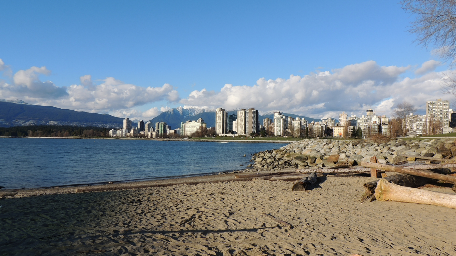
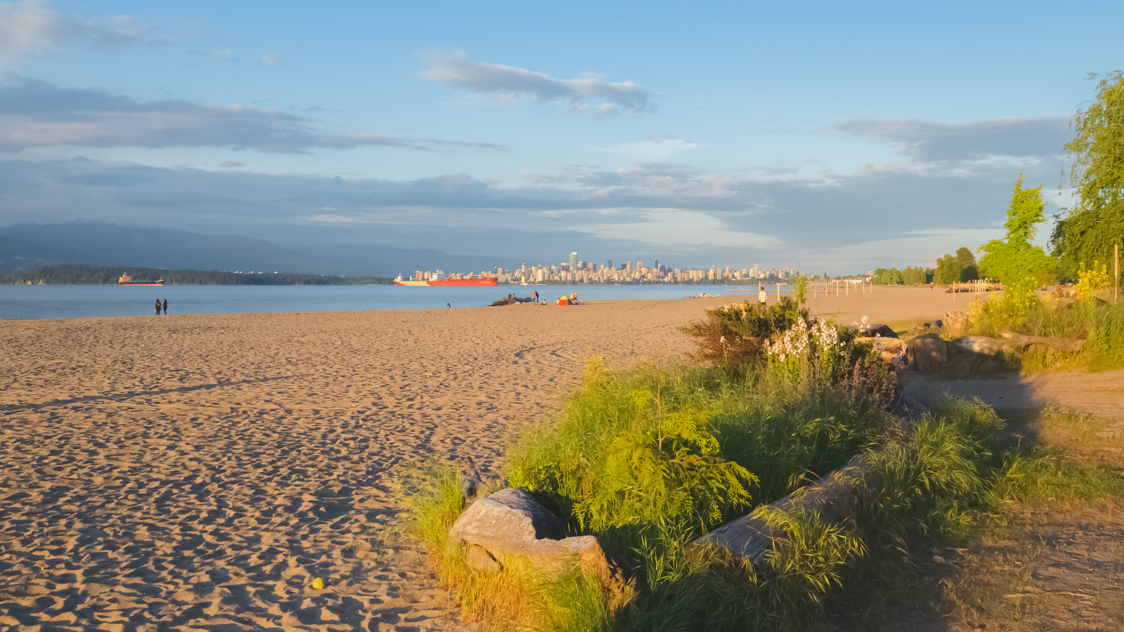
The route follows the shoreline west from Kitsilano Beach through Jericho Beach and Locarno Beach before arriving at Spanish Banks, a wide, sandy stretch of coastline at the tip of Point Grey with some of the best views of the North Shore mountains and the city skyline you will find anywhere in Vancouver. What makes it different from the Seawall is simple: the further west you ride, the fewer people you share it with.
Each beach along the way has its own character. Kitsilano Beach is lively and social, with a saltwater pool that has been a Vancouver institution since 1931. Jericho Beach is calmer, popular with windsurfers and families. Locarno is quieter still. By the time you reach Spanish Banks, you have left the tourist circuit behind almost entirely. At low tide, the water retreats to reveal a wide sandy expanse that stretches far out into English Bay, and on a clear day the views across to Vancouver Island are remarkable.
The route flows naturally from one beach to the next, with the path hugging the shoreline so closely that you can hear the waves the whole way. Most of it is paved and separated from traffic, with short sections on quiet residential streets that are well marked with cycling signs. It is a comfortable ride for most fitness levels, though riders extending to UBC will face a sustained 2-kilometre climb on NW Marine Drive before the campus, with elevation gain that makes an e-bike a smart choice unless you are genuinely comfortable with hills.
If you have a few hours and want a relaxed ride with a proper destination at the end, stopping at Spanish Banks for a picnic before riding back makes for a near-perfect half day. If you want more distance and a real climb, continuing up to UBC and looping back through Point Grey turns it into a satisfying full morning on the bike.
Bike recommendation: A city comfort bike handles this route well. An e-bike is a smart choice if you plan to extend the ride up to UBC, where the hill on NW Marine Drive is a genuine climb.
Cycle City Tip: Here is a local secret worth planning around: Spanish Banks transforms completely at low tide. The water pulls back to reveal a vast sandy expanse stretching far out into English Bay, and what is already a beautiful beach becomes something genuinely hard to believe. Check the BC tide tables before you head out and try to time your arrival for low tide. You will thank yourself later.
Route 3: The Central Valley Greenway
Vancouver to New Westminster, through the heart of the region
Distance: 25 km one way | Surface: Combination of paved off-road paths and on-street routes | Difficulty: Easy to moderate | Best for: Riders who want real distance and a proper half-day adventure
This is the route for riders who want to feel like they actually went somewhere.
The Central Valley Greenway is a 25-kilometre path connecting Science World in Vancouver to the waterfront in New Westminster, passing through Burnaby along the way. It follows the shallow valley carved by the Expo and Millennium SkyTrain lines, which means it is remarkably flat for a route that crosses three municipalities. What it lacks in dramatic scenery it more than makes up for in distance, variety, and the genuine satisfaction of arriving somewhere new under your own power.
The route starts at Science World, one of Vancouver’s most recognizable landmarks, and unfolds through a changing mix of urban neighbourhoods, green corridors, parks, and quiet residential streets. Commercial Drive is an early highlight, one of the most characterful streets in the city, lined with independent cafes, restaurants, and the kind of shops that have been there for decades. Further along, the route passes through Burnaby Lake Regional Park, where the path dips into a forested section alongside the Brunette River, a genuinely unexpected moment of quiet in the middle of a metro area.
Think of it less like a bike route and more like a choose-your-own-adventure: start at Science World, ride as far as the mood takes you, and let the train handle the return trip. The greenway officially opened in 2009 and connects to 10 SkyTrain stations along the way, which means you can hop on at any point and ride back into Vancouver if the weather changes, your legs give out, or you simply decide you have had enough. There is no commitment to the full distance if you do not want it.
It is worth being honest about one thing: not every section of this route is equally pleasant. A few stretches through Burnaby run alongside busier streets before the path returns to separated cycling infrastructure. It is not a deal-breaker, but it is worth knowing before you set off so you are not surprised when it happens.
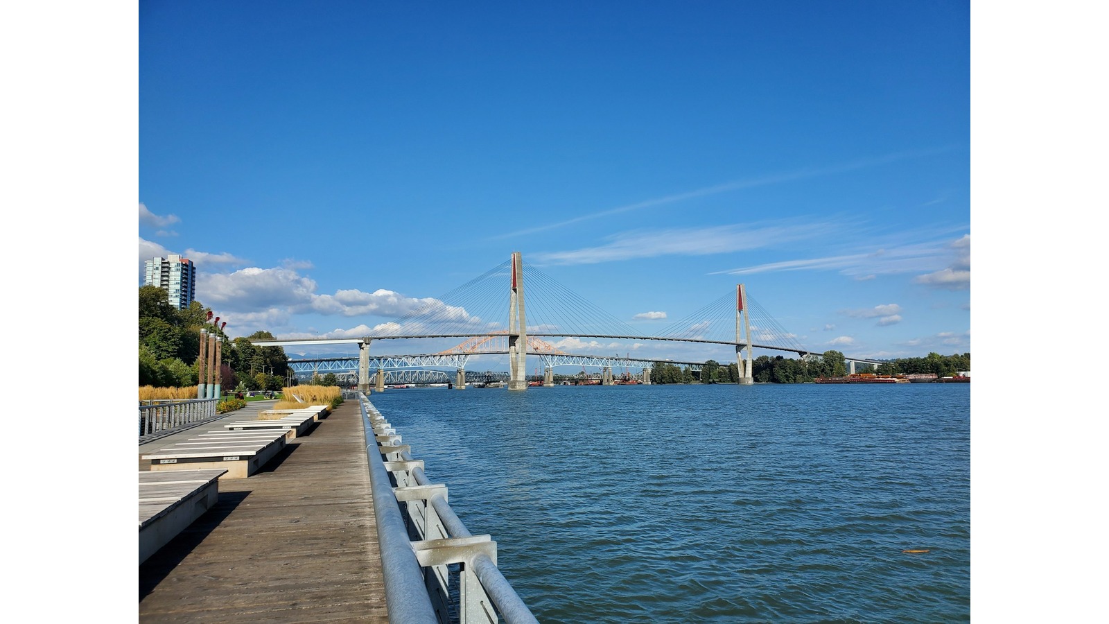
The destination makes it all worthwhile. New Westminster Quay sits at the end of the route on the banks of the Fraser River, with a public market, waterfront restaurants, and views of the river traffic that feel a long way from downtown Vancouver. It is a proper end point for a proper ride.
Bike recommendation: A city cross commuter works for this route, but an e-bike is worth considering given the distance. If you plan to ride the full 25 km one way and return the same way, an e-bike will make the return leg significantly more enjoyable. Riders who want to move quickly over the distance, including the gravel sections in Burnaby, should consider a performance gravel bike instead.
Cycle City Tip: Commercial Drive is worth slowing down for rather than cycling straight through. The strip is lined with some of the best independent cafes and bakeries in Vancouver, many with outdoor seating right along the route. It makes for a natural mid-ride break without ever having to leave your bike behind.
Route 4: Queen Elizabeth Park via the Arbutus Greenway
Gardens, views, and the highest point in the city
Distance: 23 km return | Surface: Bike paths and streets with uphill stretches | Difficulty: Moderate | Best for: Riders who want a destination with a view and a reason to linger
Every ride on this list has something worth stopping for. This one has two.
The route starts from downtown, crosses the Burrard Bridge, and picks up the Arbutus Greenway heading south through Kitsilano. So far it shares some DNA with Route 1, but it peels off from the greenway along the 37th Avenue bike route, climbing through quiet neighbourhood streets toward two of Vancouver’s most beautiful green spaces, arriving first at VanDusen Botanical Garden and then at Queen Elizabeth Park, the highest point in the city.
VanDusen Botanical Garden is 55 acres of themed gardens, serene ponds, and a hedge maze that has been delighting visitors since 1975. It is the kind of place where it is perfectly acceptable to lock up your bike and spend an hour wandering before you continue. From there, a short climb brings you to Queen Elizabeth Park, which sits at the geographic centre of Vancouver and offers something genuinely rare in a city: a 360-degree view of the entire urban landscape, with the North Shore mountains framing the skyline in every direction.
At the top of the park sits the Bloedel Conservatory, a geodesic dome housing over 500 exotic plants and more than 100 free-flying tropical birds. It is one of those Vancouver experiences that locals take for granted and visitors remember for years.
The return route comes back through the Yukon Street bikeway, drops through Olympic Village along the False Creek waterfront, and crosses the Cambie Bridge back into downtown. It is a genuinely varied loop, moving through five distinct neighbourhoods and using five of Vancouver’s connected Vancouver greenways along the way.
The climb to Queen Elizabeth Park is real. It is not brutal, but it is sustained enough that an e-bike makes a meaningful difference, especially if you want to arrive at the top with enough energy to actually enjoy the view rather than just recover from the ride.
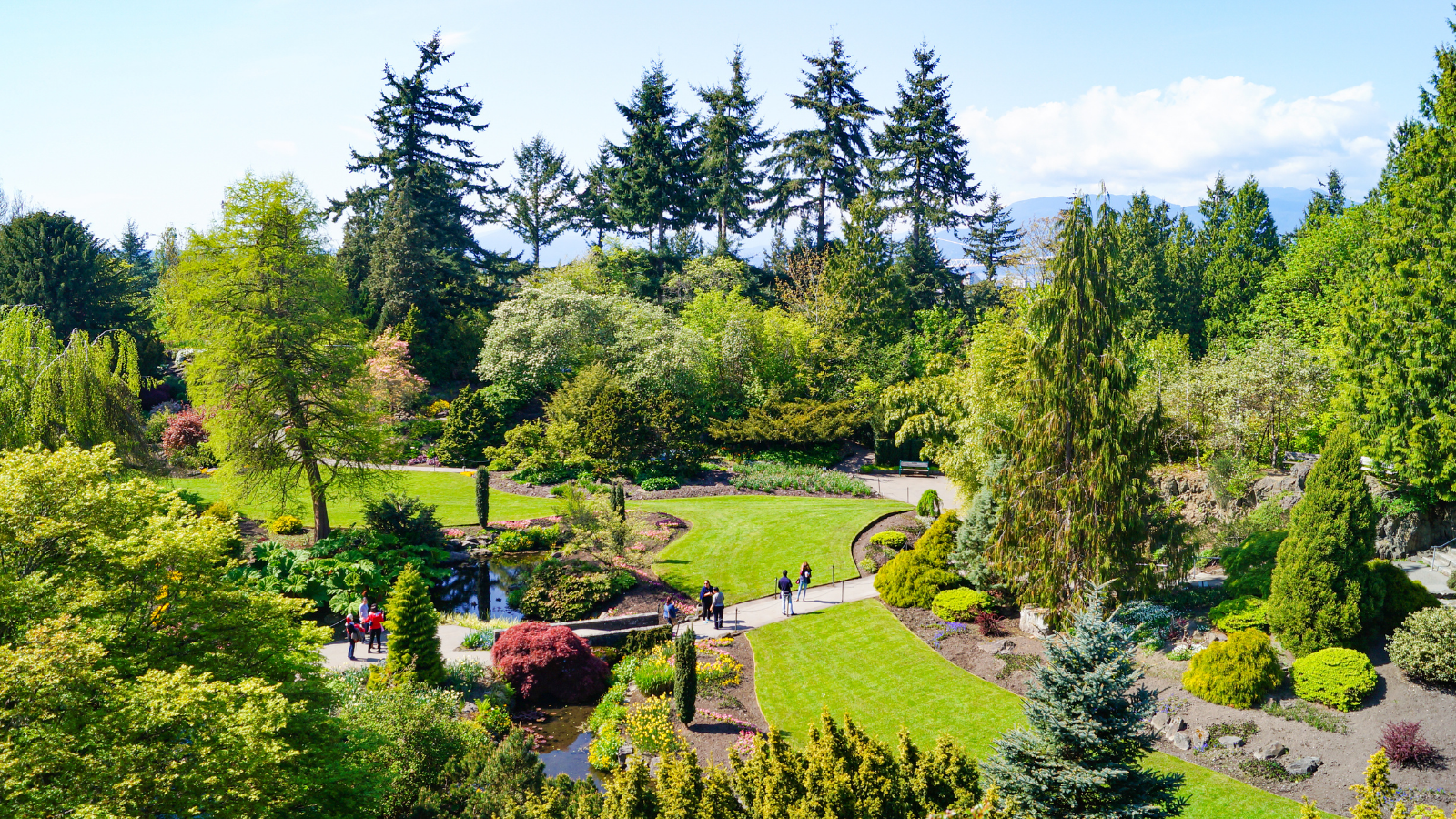
Bike recommendation: An e-bike is strongly recommended for this route. The climb through the neighbourhood streets to Queen Elizabeth Park is the most sustained ascent of any route in this guide, and the e-bike assist means you arrive at the top ready to explore rather than ready to sit down. This is one of the better road cycling routes Vancouver has for a genuine training climb, and confident riders can also tackle it on a performance road bike.
Cycle City Tip: VanDusen Botanical Garden and the Bloedel Conservatory at Queen Elizabeth Park both charge admission. If you are planning to visit both, check the current ticket prices before you set off so you can budget accordingly and decide which ones you want to include in your day.
So, Which Route Is Right for You?
Not every ride suits every day. Here is a quick way to narrow it down.
If you want something easy and local, with no agenda and no timeline, the Arbutus Greenway is your ride. Go as far as you like and turn around whenever you are ready.
If you want beaches, open water, and the feeling of leaving the city behind without actually leaving it, the seaside route to Spanish Banks is the one.
If you want real distance and a proper destination at the end, the Central Valley Greenway will give you both. Plan for a half day and take the SkyTrain back.
If you want gardens, views, and the satisfaction of earning a climb, the Queen Elizabeth Park loop delivers all three. Bring an e-bike and take your time at the top or, if you’re after road cycling routes Vancouver riders use to actually train on, tackle it on a road bike instead.
Cycle City Tip: All four routes connect back to the downtown core, which means you can mix and match sections depending on how much time you have. The Arbutus Greenway, for example, connects naturally to the Queen Elizabeth Park loop if you want to turn a half-day ride into a full one.
Conclusion
Vancouver is the kind of city that reveals itself slowly. The first time you visit, you see the postcard version. The mountains, the harbour, the park. All of it genuinely stunning, all of it exactly what you expected.
But the version that stays with you is usually found somewhere else entirely. On a quiet greenway through a neighbourhood you did not know existed. At the end of a beach where the tourist trail runs out and the city opens up into something that feels real.
That is what these four routes have in common. They are not hidden exactly, but they are not obvious either. They are the rides that locals do on a Sunday morning when they want to clear their head, and the ones that visitors talk about long after they get home.
So pick the one that fits your day. Download your map, choose your bike, and go a little further than you planned. Vancouver has a way of rewarding that.
And if you would rather have a local show you the way, we have been doing exactly that since 2010.
Prefer to explore at your own pace? Rent a Bike
About the Author
Josh is a lifelong cycling enthusiast who has traveled to far-flung corners of the world by bike. Since 2010, he and his team have built Cycle City into an award-winning, top-rated bike tour company, rental shop, and retail store in downtown Vancouver. A strong advocate for active, sustainable travel, Josh now shares that passion while raising his young family in nearby East Vancouver.